...How I survived the Otter Trail Hike.
For those who may either not have heard, or know very little about the Bataan Death March, a quick history lesson...The Bataan Death March (BDM) took place in 1942 and entailed the forced march of up to 80,000 American and Filipino POW's by the invading Japanese forces in the Philippines between Mariveles, Bataan, to Camp O'Donnell, Tarlac, a distance of between 96 and 112km. Prisoners were forced to march until they dropped dead. They were beaten when they stopped, often run over by trucks passing the column if they did not move out of the road in time. Japanese soldiers brutalised the POW's, even stealing gold teeth from their mouths when they were still alive. Very few of the Japanese soldiers were tried for what is a crime against humanity, that resulted in the deaths of up to 26,000 POW's.
My point is this: the BDM was a forced march, pretty much like the Otter Trail hike. You start at one end, and you have no option but to push on to the other end, which is five days away (coincidentally the same duration as the original BDM was). Neither of these marches were pleasant. Hiking is supposed to be a pleasant experience.
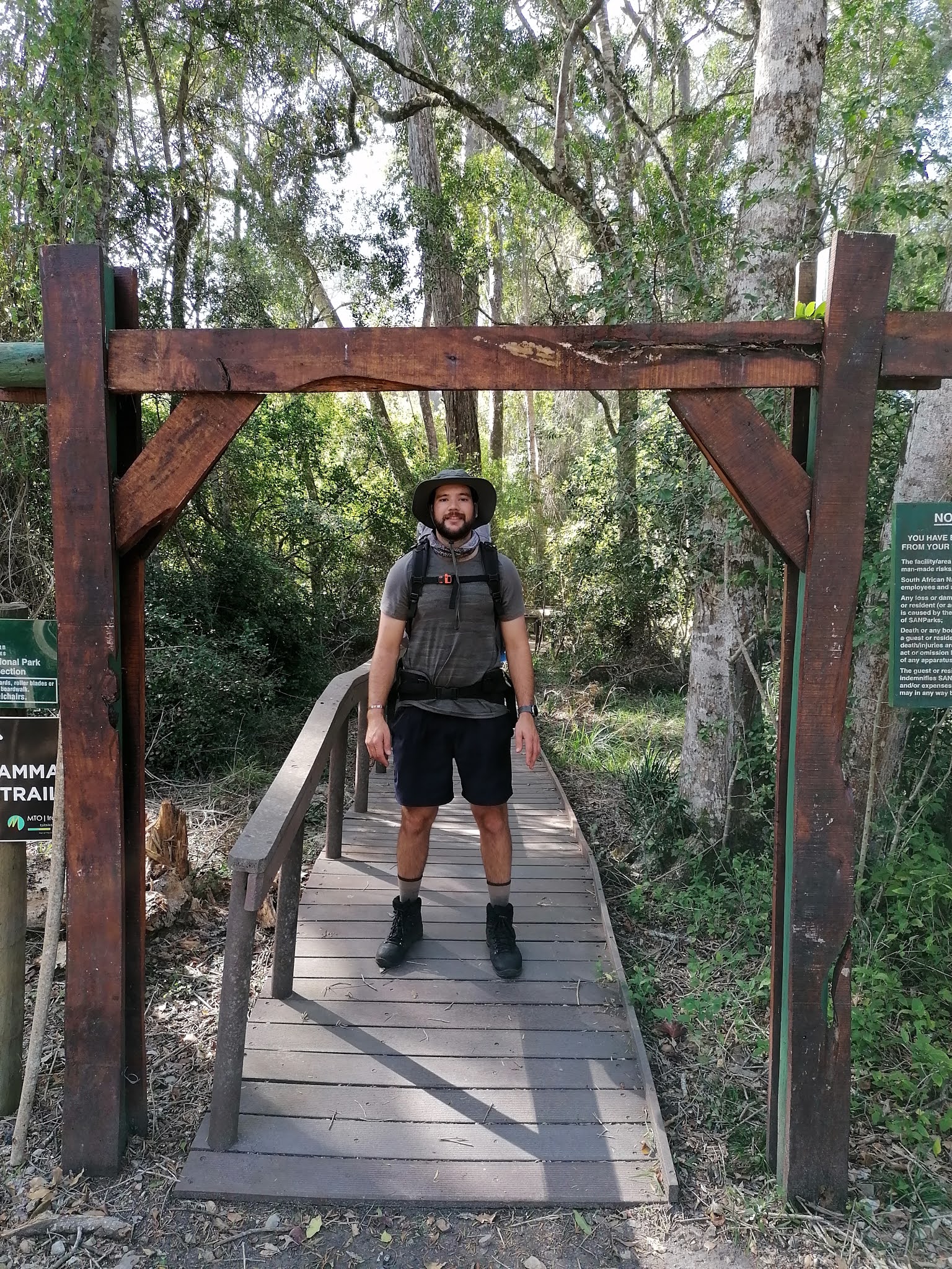
Day 1 (4.8km): Spirits were high as we left Sedgefield to be dropped off at the Storm's River departure point. The six of us had our packs packed to the gills, hoping we had everything we needed, knowing that if we didn't have it when the bakkie left us, we technically "didn't need it". A quick group photo, and off we went into the forest, heading for the ocean and our first hike over ocean-rounded boulders and rocks.


It is going to be very tricky to show the route that we took, seeing as photos cannot really do justice to elevations and angles of terrain. Let it suffice to say that, in five days of hiking, there was perhaps an area the size of a snooker table that was flat. The rest of the trail is constantly up and down steep hills. Pathways are mostly steps placed in the form of a log pole anchored across the pathway to make sure hikers have a firm foothold, and to reduce soil movement and erosion.
Our evening meal was a braaied steak, which we had packed frozen that morning, on a fresh breadroll. Not a king's fare, but a decent meal for a hike. And we each had a second steak for the following night too. Temperatures would be cool enough to make sure the meat didn't spoil.
Nights are spent in log cabins. Comfy, clean, well-maintained by SANParks staff on a daily basis. There are "escape routes" down which these people come to perform their jobs, often not being seen by hikers. The escape routes are there in case someone wants to bail out of the hike. The route ends on high ground, where dodgy mobile reception is found, and you can call a number given to you at the start of the hike. A ranger bakkie will come along and collect you, then take you back to the closest SANParks office where you can be collected. None of us bailed, though to be completely honest, it did cross my mind on the second last day. More on that later.


Day 2 (7.9km): Up at 7am, which will be our normal rising hour for the hike. My leg muscles are sore, as there is a big difference between hiking and cycling muscle groups. I am not used to this. Our routine over the next mornings remains the same as well, up at 7am, coffee and rusks, hike until an agreed point, then stop for breakfast. As the slowest of the group, I volunteer to leave camp first on all days and, in fact, at all stops as well as I don't want the group to have to wait for me.
Every day begins with a hike up a steep hill. Most of the trail is through forested areas, with few sections open to the blue sky. I reckon about 90% of the hike was walked in the shade. Not one of us was in the sun long enough to get sunburned.
Every day ends with a steep downhill section. All of the camps are built at sea level, right off the rocky beaches.
In between, there are uphills and downhills. And then there is more of the same. It never ends. Just when you think you are getting to the top of a hill, some bastard has put another up- or downhill in your path. Even in the constant shade of the trees, you sweat constantly. Hats are used mostly to wipe sweat from your brow, or to protect your head from overhead tree branches.
The paths are, for the most part, very well marked as you cannot miss the steps. Those same steps though, make the trail very difficult. On areas where there are no log steps and you can walk your own pace length, it is easier, but the steps are unevenly spaced in both height and depth. Imagine being on a stepping machine in a gym for five constant days and on a random step program, and that's pretty much the definition of the trail.

By the end of Day 2, my legs are hurting bad, and I think it can't get much worse. Hmmmm...
There are water tanks at all camps, which feed cold water showers and provide "safe" drinking water.
I developed a slight cough, not giving it too much thought as I thought I had perhaps over-exerted myself a bit.
Nights are cold and, unfortunately the wood supplied by SANParks is damp, so we battled to get a fire going. In the end, we prevailed, using my steel mess plate as a fan for the flames.

Day3 (7.7km): Deep Heat is a wonderful thing. Do not leave home without it. I can hardly move this morning and steps are an exercise in agony, especially going down. Between my thighs and my calves, each step is protested verbally by myself and it takes me a while to warm up my legs for the coming day. My little cough has got slightly worse now, but I still don't think much of it, still putting it down to over-exertion over the last couple of days.
As usual, when you get a gap in the trees, the scenery is magnificent. The ocean has been booming its presence since we stepped onto the trail on the first day. It will be our constant companion throughout the hike, becoming deafening on the last night.


Sadly, a large chunk of the trail was recently obliterated by a wildfire. At the start, SANParks folks told us it was a "controlled" fire, but the evidence points otherwise. If we wanted to hike the burned section, we had to sign another indemnity. Alternatively, we could call them on the escape route and they would send a bakkie to take us around the burned area. We signed. About half of today was spent walking through a barren, blackened and grey wasteland, ashes blowing around your feet and into the air by the constant sea breeze. The intensity of the fire was such that it even burned away a large number of the pole steps and has left this section of the trail open to soil erosion. On a positive note, there are already signs of green shoots coming through the ashes at some points. Fire is a necessity in rejuvenating some of Africa's flora, unfortunately.

I can only imagine the terror that some hikers might have experienced on the day that this fire came down to the Day 3 overnight camp. The photo does not do justice in showing just how close it came to the camp itself. Luckily, all that got damaged were a couple of water tanks and pipes that fed the camp, all easily replaced.

Day 4 (13.8km): Or in my case, almost 16km...
Insert the usual morning routine here: Deep Heat, coffee, rusk, pack the pack, bid safe trails to the group and leave camp for the nearest uphill on the opposite side of the camp stream.
Due to the wildfire, the route coming out of the camp this morning was not well marked. SANParks have been quite lax in remarking some of the burned trail. And being right at the start of the day's trail, one would think it would have been prioritised. Once you get onto the trail past the burned section, it's a breeze.
James and I left camp just after each other, me first as usual. I got up to a point where a crossroads appeared, a path leading off to the left towards some water tanks, one to the right which was a dead-end after a few metres, and a concreted road heading straight up the hill. I had a quick look about, couldn't find a trail path, so made the decision to head up the hill, hearing loggers up at the top and thinking I might get some directions from them. When I say this hill is built on at least a sixty degree angle, I am not exaggerating. AT LEAST!!
About three quarters of the way up, James hails me and I wait for him to catch up. A rest is always welcome. He is convinced we should have turned off before the crossroad, but I don't recall a pathway leading away in his direction. We see the other group (there is always two groups of six hikers on the same piece of the trail on any day) below us, milling about and then they disappear in the direction of the water tanks. We decide to follow suit and head downhill again. See if you can judge the angle on this photo for yourself.

As we get back to the crossroads, a team of SANParks maintenance crew shows up, having driven down the hill in their bakkie. We ask directions and get shown a small, badly marked path leading off to the left about 100m further down the hill from where we met them. No wonder we didn't see it, as it is in the burned section of the route. Anyway...lesson learned.
As usual, I trail behind and James saunters off on his own. Eventually the whole group gets together at a rocky point for breakfast, where we also see whales breaching out at sea. The scene is quite spectacular.
This being the longest day on the trail, also had the added "bonus" of us needing to cross the Blaauwkrantz River, and we have needed to time our crossing with the low tide. Luckily, we know from the planning stages, that low tide is just after 13h30, so we will have plenty of time to get to the river and through it before the ocean returns. It is slightly trickier than normal though, as it is neap tides, and the tide is not as low as normal. We each make our plans on how to get our packs across dry, but I don't think any of us made a completely dry crossing. Personally, I was doing well, heading for a gulley and an easy scramble up the rocks...until I put a foot into a hole that was surrounding a rock, went down face first, banged my knee on said rock and came up with a slightly damp pack and a bruised ego. Luckily nothing critical got wet and a short spell in the sun dried most of the wet stuff. Other team members weren't so lucky and got a bit wetter than I did.

After lunch, it was pack on the back again, and up the next hill.
Leaving first, I fully expected everyone to catch me quite quickly, but I didn't see another team member until ten minutes after I got to the campsite for the night. And I actually felt quite good physically. That, however, didn't last long.
Literally an hour after arriving in camp, I suddenly started to shiver uncontrollably. I didn't feel cold, but I donned my warm clothing, even jumped into my sleeping bag to get warm. It didn't help. Between us, Brian and I decided I might be a little dehydrated and he mixed me a liter of isotonic energy drink. I lay on my bunk a while, sipping occasionally, and eventually the shivering subsided. Was that all it was? No, but more about that later.
At dinner time, I helped Brian to make up our last evening meal, Toppers and Smash. Nutritious and tasty, but not a meal to be repeated on a regular basis. Following that, we all sat around the campfire, relating stories about ancestries. Based on physical features (Dupuytren's Contractures), we discovered that Brian, James, Neville and myself all have Viking blood. Dupuytren's is a hand-me-down genetic condition from the Vikings, which causes growths on the tendons (predominantly) in left hands to constrict and pull the pinky finger towards the palm of the hand. Look it up, it's fascinating. Actually, it's not, so don't.
As it was our last night, we finished off what alcohol we had left on us. In my case, it was the hip flask of Laphroaig 10yr Triple Cask single malt scotch. We toasted each other on the achievement of getting through the trail, though I suspect there were perhaps one or more than just myself that was trying to answer the question "Why?" though I don't believe any of them will admit it.

Day 5 (10.8km): Extended from the original trail end by a full 4km...
Dawn broke bright and early. We were all amped to be finishing off the trail and were all speculating what we were going to do first when we got to the end. Between hot showers, beer and pizza, those were the most popular choices.
But first, another fuckin uphill out of camp.

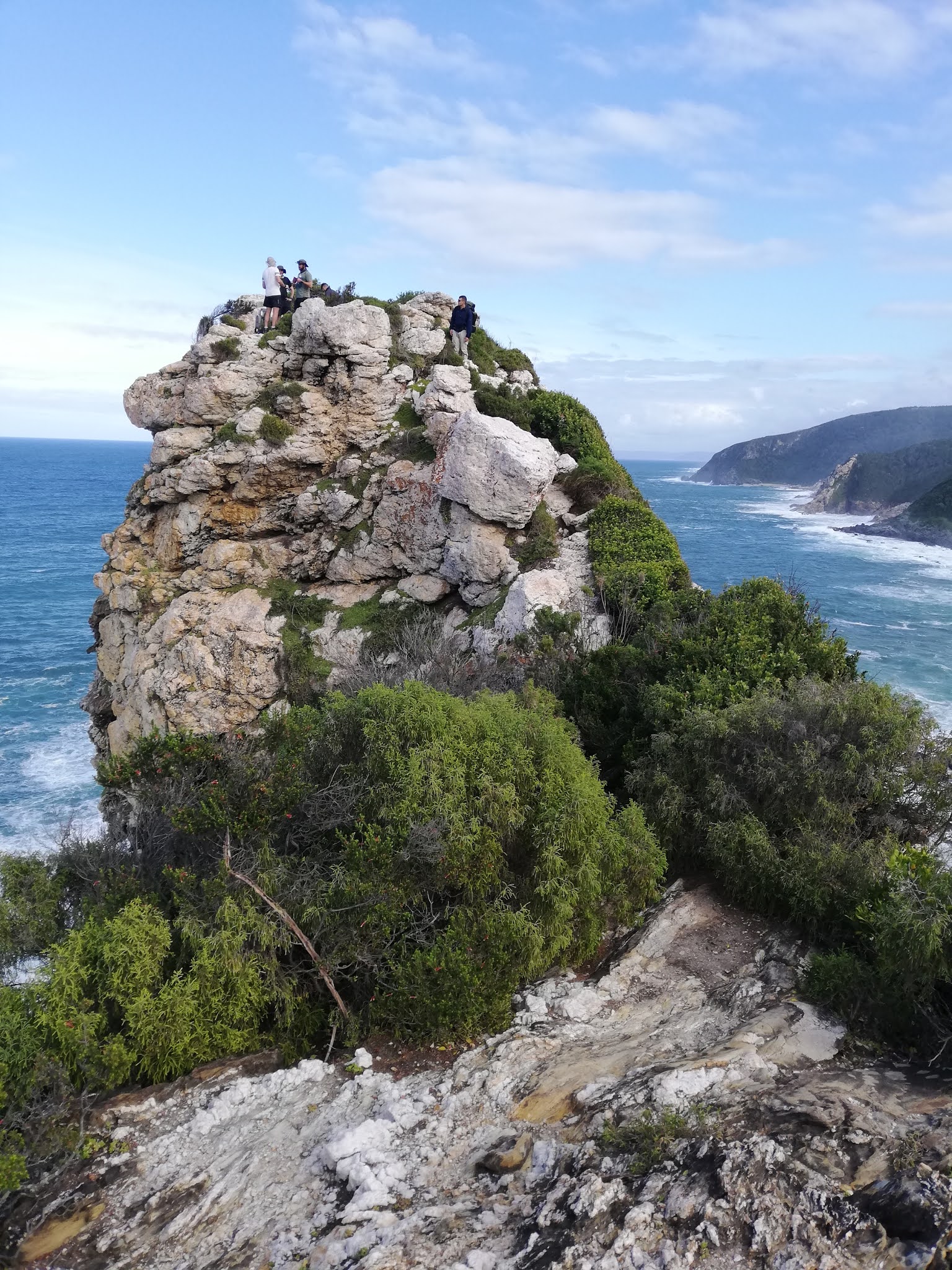
Surprisingly, perhaps because the muscles were now "getting used to this", it wasn't too difficult to get to the lookout point in the photo. Perhaps it was the thought that today it was going to be all over.
The trail was a relatively short stretch over a plateau, nice and easy walking, in the sunshine and warm air. Just a nice little pick-me-up that we all needed.
All of a sudden you get to a gate and sign that reads "no day visitors past this point" for people walking in the opposite direction. That's when you realise you are nearing the end. A steep and tricky downhill leads you onto a wide beach, other holidaymakers and beachgoers doing their thing, looking strangely at the six of us with massive packs on our backs. If only they knew what had been in those packs compared to what they saw!

From entry onto the beach, it is still a full 6km hike, over the beach and along a winding, shaded bush path. More shade. One last stream crossing as a final challenge, and then the exit gate is ahead of you. Done and dusted.


3 comments:
Wow Steven, I bow to your fighting spirit, strength and endurance. I would have ducked out one km into that trail. I have friends and family who have done it, and all I can say is their stories never did their feat any justice until I now read your amazing account of the journey. Along with your very good photographs, I can now fully grasp the significance of the title you chose for your story. And to top it all, to be fighting bloody Covid at the same time!! I salute you, you crazy Scotchman Viking. Trust you are beating Covid as well as you beat the Otter trail. Maryna
Enjoyed the read and can almost feel the pain. Luckily you were training on your bike a little before the hike. 2km hike for me is enough������
Enjoyed the read and can almost feel the pain. Luckily you were training on your bike a little before the hike. 2km hike for me is enough🤣🤣🤣
Post a Comment